 NERC Data Catalogue Service
Coal resource maps
Type of resources
Topics
Keywords
Contact for the resource
Provided by
Years
Formats
Representation types
Update frequencies
Scale
-
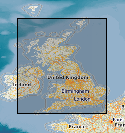
Several coal resource maps for the whole of the UK have been produced by the British Geological Survey as a result of joint work with Department of Trade and Industry and the Coal Authority. The UK Coal Resource for new exploitation technologies map is a map of Britain depicting the spatial extent of the principal coal resources overlayed with existing workings and potential new technologies for accessing the resource. The map also shows the areas where coal and lignite are present at the surface and also where coal is buried at depth beneath younger rocks. The project covers all onshore coalfields in the UK, including Northern Ireland. It includes coal under estuaries and near-shore areas that can practically be reached by land-based directional drilling. No data more than 5 km offshore were considered. The maps are intended to be used for resource development, energy policy, strategic planning, land-use planning, the indication of hazard in mined areas, environment assessment and as a teaching aid. In addition to a summary map at 1:750000 scale for Britain data also exists for each technology of 21 individual regions or coal fields at a scale of 1:100000. The data was published in printed map form for the summary map, inkjet plots for the 42 individual maps and as PDF documents on CD. The maps were accompanied by BGS report CR/04/015N, "UK Coal Resource for New Technologies, Final Report". The work was initiated in April 2002 and completed in October 2003. The data was also simplified for inclusion in the Britain Beneath your Feet atlas 2005.
-

Coal resource maps for the whole of the UK have been produced by the British Geological Survey as a result of joint work with Department of Trade and Industry and the Coal Authority. The Coal Resources Map is a Map of Britain depicting the spatial extent of the principal coal resources. The map shows the areas where coal and lignite are present at the surface and also where coal is buried at depth beneath younger rocks. The maps are intended to be used for resource development, energy policy, strategic planning, land-use planning, the indication of hazard in mined areas, environment assessment and as a teaching aid. In addition to a general map of coal resources for Britain data also exists for the six inset maps: Scotland; North-East; North-West; East Pennines; Lancashire, North Wales and the West Midlands; South Wales, Forest of Dean and Bristol. Available as a paper map, flat or folded, from BGS Sales or as a pdf on a CD if requested.
-
The UK contains extensive resources of coal, both at surface and in the subsurface. It is estimated that onshore these surface and subsurface deposits cover an area of approximately 40,000 km2. This dataset is derived from a 2004 study to assess the potential of the UK onshore coal resources for both exploitation by conventional (mining) and new technologies. Digital data was created using a Geographic Information System (GIS) to produce the delivered output of the original project, a series of paper maps that would identify prospective areas. The dataset layers include: Mining Technologies: Area with technical potential for opencast workings (source Coal Resource Map of Great Britain BGS/Coal Authority 1999) Underground mining exploration prospects Good prospects for abandoned mine methane (AMM) (Mine workings not recovered) Resource area for coal mine methane (CMM) (source Coal Authority Underground Licences, May 2002) Extent of underground workings with 500m buffer zone (based on Coal Authority data, May 2002) New Technologies: Area greater than 1200m from surface with potential for CO2 sequestration Area with good coalbed methane (CBM) potential Underground coal gasification (UCG) potential Coalbed methane (CBM) resource area Coal-bearing strata